{ }
Showing posts with label Recreation. Show all posts

Kolbano Beach Kupang Indonesia

Kalbano Beach

 About Kolbano Beach

Bit bored with beautiful beaches with white sand? Try this one, the beach of Kolbano. It is very unique because it is not made of white sand but of colorful stones.

The beach is located in the Village Kolbano, Kolbano District, South Central Timor (TTS), East Nusa Tenggara province with total area of ??17 km2. Kolbano Beach is famous for its colored stones and the stones have been mined and traded by the local population since 1971. These stones are usually used as decorative stone in gardens.

This beach has various forms of rocks and a variety of colors like red, green, yellow, black, patterned stones and even those have three colors (red, black and beige).

Getting to Kolbano Beach

This beach can be reached by using Mandala Airlines, Sriwijaya Airlines, Merpati Airlines or Batavia Airlines to get in Kupang.

On arrival in Kupang you can continue your journey by city bus to Kolbano (Rp.60.000), it takes about 6 hours. Because the bus takes 6 hours for a one-way trip it is better to stay the night in Kupang and get on the 6:00 am bus to Kolbano.

NATIONAL MONUMENT (MONAS), JAKARTA, WEST JAVA, INDONESIA

MONUMEN NASIONAL (MONAS)

About National Monument (Monas)

The National Monument Monas (Monumen Nasional) is a 132 meter high tower in Jakarta standing in the middle of Medan Merdeka (Merdeka Square). The monument symbolizes the Indonesian independence struggle.

President Sukarno directed the construction of Monas which began in 1961. It was opened to the public only 14 years later at 12 July 1975 due to construction problems. The monument consists of two parts. The first part is the base platform called the goblet, at a height of 17 meters. Above this is the 117.7 meter tall obelisk made of Italian marble. The goblet represent the Yoni, which resembles a lesung rice mortar (grinder cup) and symbolizes the female organs while the obelisk resembles Lingga, an alu rice pestle (the grinder) symbolizing the male organs.

At the top of the monument is a golden flame called the Flame of Independence. The flame 14 meters heigh and is made of 14.5 ton bronze coated by 50kg of gold.

At a height of 115 meter is a 11x11 meter viewing platform which can be reached by an elevator at the south side of the structure. Binoculars are provided to fully enjoy the Jakarta skyline. A ticket to the Monas viewing platform is Rp. 7,500.

Inside the goblet is the Hall of Independence (Ruang Kemerdekaan) containing various symbols of the Indonesian independence like the original text of the Proclamation of Independence, a map of the archipelago coated in gold and the Indonesian coat of arms.

A level below, inside the base of Monas is the Indonesian National History Museum. Inside are 51 diorama's (three dimensional models) telling the history of Indonesia from the prehistory to recent times.

Around the monument is a big park where you can hide for a minute from the Jakarta traffic.

TAMAN MINI INDONESIA INDAH


About Taman Mini Indonesia Indah

About Taman Mini Indonesia Indah

Taman Mini Indonesia Indah or often shortened as TMII is a cultural themed Indonesian tourist area located in East Jakarta.

TMII is basically a summary of various aspects of the life's of the Indonesian people who are spread over 26 provinces (in 1975). In the middle of the park there is a miniature lake depicting the Indonesian archipelago. TMII was opened in 1991 by Mrs. Tien Soeharto.

As for the parts of TMII namely:
  • Pavillion area
    This is the area that includes a variety of buildings in the traditional architecture of almost every ethnic group in Indonesia.
  • Religious Buildings
    Representing a variety of buildings or places of worship which are famous in Indonesia, it also illustrates the harmony and inter-religious harmony in Indonesia. The buildings include:
    1. Diponegoro Mosque
    2. Catholic Church of Santa Cantharina
    3. the Hallelujah Protestant Church
    4. Pura Penataraan Agung Kertabumi
    5. Wihara Arya Dwipa Arama
    6. Sasana Adirasa Pangaeran Samber Nyawa
    7. Confucian Temple
  • Recreation Facilities
    There are a number of recreational facilities that makes TMII a good place to go to with children. In addition to the natural surroundings, cleanliness and the many rides for children, TMII can increase the knowledge about Indonesia and about its cultural diversity. The recreation facilities of TMII include:
    1. Indonesian Children's Palace
    2. Hanging Train
    3. Swan Boat Arsipel Indonesia
    4. Park Among Putro
    5. Park Ria Atmaja
    6. Village Tourism
    7. Swimming pool Snow Bay (Rp 25,000 per person)
  • Theatre and Cinema
    Buildings which are specifically used as a place of art performances and movies, among others:
    1. IMAX Teater Keong Mas, in this IMAX theater are a variety of environmental-themed films played.
    2. Teater My Homeland
    3. Teater 4D A normal 3D theater but with the addition of smell.
  • Parks
    Built specifically to show the beauty of the flora and fauna in Indonesia there are ten parks in the TMII area, namely:
    1. Orchid Garden (Taman Anggrek)
    2. Garden of the Pharmacy of Life (Taman Apotek Hidup)
    3. Cactus Garden (Taman Kaktus)
    4. Jasmin Garden (Taman Melati)
    5. Taman Bunga Keong Mas
    6. Freshwater Fish Aquarium (Akuarium Ikan Air Tawar)
    7. Bekisar Park
    8. Bird Park
    9. Ria Atma Park, with a stage for musical performances
    10. Indonesian Chinese Cultural Park
  • Museums
    The museums store and display a variety of historical, technological and cultural objects, as well as specimens from the flora and fauna in Indonesia. For a price of Rp 2000 you can visit no less than 14 museums who are all located in this area. Among others:
    1. Museum Indonesia
    2. Museum Purna Bakti Pertiwi
    3. Soldiers Museum (Museum Keprajuritan)
    4. Stamp Museum (Museum Prangko)
    5. Heritage Museum (Museum Pusaka)
    6. Transport Museum (Museum Transportasi)
    7. Museum of Electricity and New Energy (Museum Listrik dan Energi Bar)
    8. Telecommunications museum (Museum Telekomunikasi)
    9. Information Museum (Museum Penerangan)
    10. Sports Museum (Museum Olahraga)
    11. Asmat Museum
    12. Indonesia Wildlife Museum and Reptile Park (Museum Satwa Indonesia Komodo dan Reptil)
    13. Insect Museum ((Museum Serangga)
    14. Central Museum of Science and Technology Demonstration ((Museum Pusat Peragaan Ilmu Pengetahuan dan Teknologi)
    15. Oil and Gas Museum (Museum Minyak dan Gas Bumi)
    16. Museum of East Timor (Museum Timor Leste)

RAGUNAN ZOO

RAGUNAN ZOO

About Ragunan Zoo

Jakarta's Ragunan Zoo is located in Pasar Minggu, South Jakarta. It is the home for over 4000 animals and 260 species, most of these are endangered and threatened throughout Indonesia and the world. It has a good collection of Indonesian wildlife, including Komodo Dragons, orangutans and tigers.

The Ragunan Zoo was established in 1864 by the Vereneging Planten en Dierentuin, a Dutch East Indies organization for flora and fauna lovers. At first it was in Central Jakarta at the Cikini area, it moved to its current location in 1966. It is set in a lush tropical surrounding.

The Zoo includes the Schmutzer Primate Center, named after Pauline Schmutzer who donated her estate to the center. The purpose of the center is to provide primates such as gorillas, orangutans and chimpanzees a natural habitat as possible. For instance, at the orangutan area thick dark glass prevents the orangutans for seeing the visitors while they can see the animals.

The zoo is ideal for children as it includes a Childrens Zoo, elephant and boat rides, a pony cart and playgrounds.

ANCOL BAY CITY

Ancol Bay City
 About Ancol Bay City

Ancol Bay City or also known as Ancol Dreamland is the largest and most attractive recreation park in the Jakarta area. It consists amongst others of a golf course, a theme park, hotels, nightclubs and swimming pools. It is located at the north of Jakarta on reclaimed land at the Bay of Jakarta.
Ancol Bay City
Entertainment at Ancol Dreamland:

  • Fantasy World (Dunia fantasi). Jakarta's theme park with over 40 rides and attractions including the Halilintar twisted roller coaster and shows. Ticket price for entrance to Fantasy World is Rp 135,000 per person on weekdays.
  • Atlantis Water adventure. A five hectare large water park themed on the mythological city of Atlantis with a wave pool, waterfall pool, slides, children's pools, continues flowing river pool and restaurants. Entrance is Rp 90,000 on weekdays
  • Sea world. One of the largest oceanarium in South East Asia featuring pools for alligators and sharks, and a few general pools as the Sea friends pool and the Main pool
  • Pasar Seni: An art market which in the course of it's 25 years history has become a center for handicrafts and other art products as well as a center for artists to directly create and sell their products.
  • Executive Golf Fun, Ancol's 18 holes international beach golf course.
  • Beaches. Within the resort you can find the Carnival beach and the Festival beach.

Ujung Genteng Beach

About Ujung Genteng Beach


The Pantai Ujung Genteng (Ujung Genteng Beach) is located on the south coast of Java, at the Indian Ocean in the Ciracap District, West Java. The sea is fairly quiet here with relatively small waves due to the rocks on the sides of the beach. The sea water is very clear which makes it possible to see the coral and fish with the naked eye without snorkeling. This is also a favorite place to watch the sunset.


In this area are many things to see and do amongst others:
  • Aquarium Cibuaya. This is a natural aquarium where the fish are kept in holes on the beach. Located at Cibuaya Beach.
  • Pengumbuhan Beach, a favorite place for surfers and the Green Turtle, but then for laying their eggs.
  • Tebing Amanda Ratu (Amanda Ratu Cliff). Here you will feel as you were at the Tanah Lot (Bali) because of the huge rock in the sea where the waves hit upon as at Tanah Lot.
  • Curung Cikasa (Cikasa Waterfall). Not far from the Ujung Genteng Beach is this waterfall where you can see three waterfalls at the same time.
  • Sugar Making, in this area sugar is made by collecting fluids from the coconut tree which is then processed to make sugar.

Getting to Ujung Genteng Beach


From the Indonesian capital Jakarta the beach is about 220km away, from Bandung 230km. It would take about 6 to 7 hours by car as the road is quite good.

With bus it will take about 10 hours since you need to transfer a few times. From Jakarta take a bus to Sukabumi, transfer there to a bus or minivan then to Lembursitu. At Lembursitu take a public minivan to Surade. At the Surade terminal walk out to the main road to get an angkot to Ujung Genteng.

Situ Patenggang

Situ Patenggang


About Situ Patenggang

Lake Patenggang or also known as Situ Patenggang (which means lake in the Sundanese language) is situated about 1600 meters above sea level. The lake is located in Ciwidey Patenggang about 47 kilometers south of the city of Bandung, West Java, about a 2 hours drive. The journey to Situ is still very natural with lots of green of the trees on the side of the road which provide a shade on the road and numerous tea plantations and strawberry farms. Besides the fresh air and the natural surroundings the many curves in the road makes the journey to Sity Patenggang also a joy to ride.

Arriving in Situ, you will be greeted with an impressive lake, with mountains towering around it. On the edge of the lake there are numerous beautiful boats with bright colors, ready to take you around the lake for Rp. 15,000 per person. Or if you do not want to get around too far away you can also rent a water bicycle and go by yourself. You can also just sit by the lake and enjoy the serenity of this place and its natural beauty.

Batu Cinta (Rock of love)
Situ patengan not only offers the charm of nature, it also contains the famous and historic island of Asmara (Pulau Asmara) and the Batu Cinta. Pulau Asmara and Batu Cinta is located in the middle of the lake with a large stone. The stone is called Batu Cinta (Rock of love) and has a legendary story. This story stems from a love story of two lovers Ki Santang and Dewi Rengganis separated and eventually reunited in this place. Local people believe the water that fills the lake is a tear of the Ki Santang and Dewi Rengganis, which is why some people call this lake Situ Penganten (bride). Usually the tourists who visit Situ will also visit the Rock of Love. It is said that for anyone who arrive with a partner to the Rock of Love and have gone around the island, then the relationship will be durable and lasting.

Besides the beautiful nature, around the lake are shops that offer a variety of souvenirs or fresh fruits which of course you can take home as souvenirs for relatives. If you want to stay longer there are also several hotels and bungalows with adequate facilities.

White Crater Lake, Bandung, West Java, Indonesia

White Crater (Kawah Putih)

About White Crater Lake

White crater (Kawah Putih) is a crater lake of Gunung Patuha, not far from Situ Patenggang (5km), and is located approximately 46 kilometers south of Bandung 35 kilometers from Soreang and takes about 2.5 hours drive from Bandung. Temperatures here are between 8-22 degrees. There are two craters, the Saat Crater (Saat in Sundanese language means subside) is in the west and the White crater underneath it at an altitude of 2194 meters. Both craters are formed by an eruption that occurred around the tenth or eleventh century
Long ago before the White crater opened to the public, local communities believe that the White Crater was haunted because of the many birds that die while traversing the White Crater, but in 1837 a scientist from Germany, Dr. Franz Wilhelm Junghun arrived. He then did research and found that many birds die when crossing the area is only caused by sulfur due to lava bursts.

Because the sulfur content is very high in the White crater the Dutch had built a sulfur factory in named Zwavel Ontgining Kawah Putih which later during the Japanese occupations had its name changed to Kawah Putih Kenzanka Gokoya Ciwidey.
Then in 1987 PT. Perhutani unit III West Java, Banten began to develop the White Crater area as a tourist attraction, since the White Crater lake was absolutely stunning. The White Crater Lake has the unique characteristic of water that can change color: like apple green, bluish when exposed to the light reflection of the sun, sometimes looks like chocolate milk, but the water is most commonly seen as white with a thick fog on it. This area is often used for pre-wedding photos because of the exotic views.
The White Crater Lake is open for tourists from 07:00 until 17.00 hours, every day. The facilities available are adequate with a parking lot, transportion, information center and food stalls. Admission rates for White crater is fairly expensive: for cars up to Rp. 150,000 to get on top of the White Crater region, Rp.35.000 for motorcycles and Rp. 15,000 per person.

Getting to White Crater Lake

From Jakarta: take the toll road Cipularang and get off at the toll exit Kopo, then head to Soreang south of the city Ciwidey. From Ciwidey it is about 20 to 30 minutes to the entrance of the White Crater. Visitors are advised to use the car to get to the White crater due to its distance from the entrance (about 5.6 Kilometers) and quite steep.
If you use a private vehicle and you can go straight to the parking area not far from the White crater.
You can also use public transportion from Terminal Kebun Kelapa as well as Leuwi Panjang in Bandung, heading first to Ciwidey. Then proceed using local transportation heading for Situ Patenggan.


West Bali National Park

West Bali National Park

About West Bali National Park

Set at the western tip of Bali, close to Java, the West Bali National Park (Taman Nasional Bali Barat, or TNBB) covers an area of 19.003 hectare of which 3200 hectares of coastal waters and coral reefs. Unlike most of the other National Parks in Indonesia the vegetation is not tropical rainforest but, due to lack of rain in this area, coastal savannah. The southern side receives more rain and here the vegetation is more tropical, also the coastal lands are made up of mangrove forests. In the sea are several coral islands. The land area is characterized by the remains of four Pleistocene volcanic mountains with Gunung Patas the highest at 1412 meters.

There are about 200 species of plants in the West Bali National Park, 300 species of birds and many other forms of wildlife including several species of monkeys (leaf monkeys, macaques and black monkeys), deers, pigs, iguanas and several species of snakes.

The entrance and Park headquarters are at Cekik where you can arrange guides and permits. There is also a visitors' centre at Labuhan Lalang. If you want to go trekking in the park a certified guide is mandatory and expensive. A guide for a day can cost up to Rp 400,000 depending on the size of the group and the length of the trek.
There are set trails in the Park but you will see the most wildlife and enjoy the nature more fully if you go off the trail. Here you will be surrounded by quietness only interrupted by rustling trees and the sound of the overly abundant birds.

LOVINA BEACH, DENPASAR BALI


About Lovina Beach

Lovina Beach is located on the north coast of Bali, approximately 10 km west of Singaraja in Kalibukbuk Village, Buleleng Regency, Bali. Lovina Beach is famous for its dolphin attraction, because of this a dolphin-shaped statue as high as +/- 5 meters was built near the entrance to the tourist area. You can see dolphins in the middle of the ocean waters in front of Lovina, about one kilometers into the sea. The waves at Lovina beach are relatively quiet so you can safely go on the ocean with a fisherman boat.

Loviana beach area is unique and famous because you can see firsthand hundreds of wild dolphins, and they are very cute and friendly. This will be a fun and exciting holiday experience. But to be able to see those hundreds of dolphins you have to leave in the morning before the sun will rise, since the dolphins in the Lovina area are usually only visible at about 6 to 8 am. You can rent a small fishing boat which can carry up to four people.

If you are not lucky to directly see the dolphins, don�t worry, you can still enjoy the beach which is one of the best in Bali. Lovina is also good for diving or snorkeling. You can find a variety of tropical fish that are quite friendly and easily approached by divers. Lovina beach is popular too because of the many lodging facilities for quite affordable rates, ranging from a budget accommodation to your own cottage. There are also hotels that provide a trained dolphin attraction and some even have a miniature zoo.

TANAH LOT, DENPASAR BALI

About Tanah Lot

The Tanah Lot temple (Pura Tanah Lot) is located in the village of Beraban, Tabanan District, about 13 km west of Tabanan, Bali.

Tanah Lot is famous for being a beautiful place to watch the sunset. Pura Tanah Lot was built by a priest from East Java named Dang Hyang Nirartha who was traveling east to spread the Hindu religion. The temple is one of seven sea temples around the Balinese coast.

Pura Tanah Lot has was build according to the concept of Triangga (depictions of the human body from head to toes), similar with 2 other sacred places in Tabanan, Pura Luhur Batukaru (head) and Tasik Puser Pura (middle) with the Pura Tanah Lot as the toes.

In the north temple, precisely in the cave under the cliffs, there are sacred, black yellow and poisonous snakes. It is said that snakes where a scarf for Dang Hyang Nirartha when she was imprisoned and became a guardian of the temple. In this place there is also a fresh water source named Tirta Pabersihan commonly used as a means of pleading for purity.

In the vicinity of Tanah Lot, are many art shops and a variety of expensive resorts such as Le Meredien with golf field facilities. Near the parking area are many native Balinese souvenir sellers.

Just north of Tanah Lot Temple is a temple (Batu Bolong) situated on a cliff that juts into the sea. This cliff temple connects with the land and is shaped like a bridge.

KUTA BEACH

Kuta Beach

Kuta Beach is located in Badung Regency, only 9 km from Denpasar. Denpasar is the capital of Bali, Island of Bali. 
Previously, Kuta is the fishermen village. Now, Kuta has become a destination for foreign tourists. 
Kuta area is called the International City. The icon is given because of Kuta is the place to meet tourists from all over the world. 
Now Kuta has changed into a small international town owns complete tourism facilities.

Activities in the Kuta Beach: 
In the morning until the afternoon 
Activities that can be done is sunbathing on the beach, swimming, surfing sports, beach volleyball, walk along the beach. 
Kuta Beach is the ideal place for sports as surfing. 
Kuta Beach is wide and white sandy is liked most by tourists to sunbath, swimming, or surfing.

In the afternoon 
Kuta Beach is famous scenic sunset, many tourists who come for the afternoon to see the beautiful sunset. The sunset in Kuta is most breathtaking.
At sunset, the beach is a lively place, and the roads are full of cars and motorbikes.
Kuta Beach is known as sunset beach while Sanur Beach is known as sunrise beach. 

In the evening
At night, Kuta is alive with night life. The village abounds with restaurants, shops, pubs, discotheques, dance clubs and other tourist facilities.
Almost every evening there is a performance of Bali Dance somewhere in Kuta.

Facilities available in the Kuta area 
Facilities available are the hotel, lodging, swimming pool, spa, bars, shops, souvenir shops. 
Kuta area has full facilities, many other supporting facilities available.

SANUR BEACH

SANUR BEACH

Sanur Beach is located in Sanur Village, approximately 6 km from the City of Denpasar, Bali Province, Island of Bali. Sanur beach is easily reachable from Denpasar, about a 5 to 10 minute drive.

Sanur beach is the beach for family recreation, many families come from the City of Denpasar to Sanur beach for relaxing.

Activities in the Sanur Beach, Bali:
Sanur Beach has waves that are not too big so that is suitable to perform activities such as swimming, bathing in the sea, canoeist sport, fish fishing, parasailing and other activities.
In the Sanur Beach, we can jog along the white sandy beach.

At Sanur beach, many foreign tourists sunbathing on the beach while enjoying the beautiful Sanur Beach.
Sanur beach famous for the beautiful sunrise. Sunrise in the morning in Sanur Beach with so beautiful. Sanur Beach is an excellent site to watch the sunrise.

It is interesting in the Sanur Beach
● In the north of Sanur Beach, the beach form a circle like a half circle.
● The south coast turn from east to west.
● When the sea water receding, it will show the beauty of coral reefs.
● Nusa Penida island across the sea can be seen from the Sanur Beach.
● From Sanur Beach, Serangan Island across the sea can be seen.
● In the area of Sanur beach, it’s found a museum, its name is Le Mayeur Museum.

Facilities available
Around Sanur beach there are many star hotels, hotel, lodging, villas, resorts, restaurants, fast food restaurants, souvenir shops

Sacred Tomb Cinunuk


Natural Physical Environment
Tourism has a vast tomb Cinunuk 23.85 ha, and administrative boundaries as follows:
North: Village Wanaradja
West: Village Banyuresmi
South: Village Situ Sari
East Village Long Tegal
Building the tomb is divided into two parts, namely at the tomb of the outside of the right side, there are 9 left 12 graves and the tomb, while on the inside of the tomb there are four tombs. To visit the Tomb of Cinunuk can be accompanied by a number Kuncen 9 people and is a descendant of Raden Papah. The tomb is managed by Mr Rukayad Families who were the offspring / the 4th generation of Raden Papah.

Special Aspects
Raden Raden Wangsa Muhammad Papah or an elder as well as spreaders of Islam in Sub Wanaradja. He is a figure that is still known as a propagator of Islam.
Cinunuk tomb complex has several facilities which are: 3 fruit hawker stalls
Parking lot with an area of ​​170 m2
2 pieces of public toilets
1 piece Shelter
health posts
2 pieces of places of worship.
clinic within 100 m of the area.
This tomb complex has no accommodation facilities. Nearest accommodation facilities are Layung Sari Camping in JI.Wanaradja Raya No.1, seclangkan security facilities similar to those contained in the Village Cinunuk.
In the tomb complex is no special information center, but visitors who come to obtain information about the tomb of the pack Rukayad Kuncen.

Towards Accessibility Object
Cinunuk Tomb Complex is 2 miles from the center Wanaradja District, 12 km to the Garut regency. and 63 km to the provincial capital of Bandung. For accessibility aspects of the Tomb of Cinunuk pass road districts with road length of 20 m from the district office Wanaradja, access roads of rural roads with a length of 1.2 km and a width of 3 m and a path in the form of foot path with a length of 20 meters wide and 1.2 m. For the achievement to the destination can use the city transportation department of transportation Sukawening beginning of the road until the road access. Of rapid access road transport OJEG.


 Read Source>> 
 

TALAGA BODAS


Garut is already famous for its dodolnya now increasingly innovative with an assortment of fruit flavors. But if you want to know more, will surely agree that the beauty of their arrowroot instead of just lunkhead.

Talaga Bodas is one proof of that charm is not just lunkhead Garut. That day the second Saturday in 2009, the fog covering the sun from view when I arrived at the lip Talaga Bodas. I let my guide who was also a motorcycle I returned to the post to leave his motorcycle, while I was busy photographer aiming his Nikon standard lens in my hand. No one else is visible around the lake, though there was a scream that echoed, reflected repeatedly between the hills that surround the place.

Hilltops already enveloped in mist that moves down, but no visible signs of rain. It's still good, although the sky was not visible at all, nature is still welcomed us. The entire surface of the lake and its surroundings are still clearly visible to immortalized the memory card into digital data. But I had to hurry because the weather in the mountains can change quickly.

Talaga beach trip tracing starts to the left. This time let me use the word for left-right direction, instead of north south east west. Hiking trail winding orientation system has destroyed my subconscious, let alone navigation system. While the sun was not visible, and no large mossy plants for future reference east-west direction as taught in classes or Land Navigation Survival.

Just a few steps to follow the edge of the lake, warm water bursts from beneath the sand with a bang-bang typical volcano divert attention and focus my camera for a while. But our guide was reminded, in front there is still much bigger and exciting. Well, I believe, then we continued on foot.

After about a quarter of the lake we live, we come across a hillside like a peeling. It's the rest of the eruption is still not overgrown plants. As a split Papandayan slopes when the eruption in 2003, this place is also filled with hot mud wells (but not Lapindo) with the characteristic odor of sulfur. I try to climb the little hill of bare parts, and then photographing the lake view from the top. His picture below. After being photographed, I asked the guide a quick break while enjoying the panorama of the lake. I then handed one of two bottles of beverage packaging to him, and offer a snack of chocolate. Then the journey continued.

When almost at the edge of the lake across from where we came, sounded like a waterfall from the trees. When approached, it is true there is a small waterfall near the former bivouac newly abandoned. Here of course the source of drinking water for their camping. Not far from there there are two storage pools of hot water (heat is no longer warm) and shower. Here a shower or bath, said guide. It had not occurred to shower let alone a bath because besides there is no preparation, water temperature exceeds the limits of tolerance here in the dermis layer of my body. Not to mention when looking toward the shower water flows, there is a big pile of pants and shorts in the former people who shower and bath. Akh, littering the mountain and the lake alone.

From here we continued our journey through the path between the grass-length. Then we found the five people who were sitting around the fireplace and busy butchering the meat of animals the size of a young goat or dog. No mean to interrupt, we only excuse and left, went on until arriving back at where we started around the lake. When completed around the lake, two motorcycle-style trail riders arrive at the lake, pausing to observe the street, then drive his motorcycle that roared again broke the silence of the atmosphere of the lake that afternoon. At that time, the fog has come down even further to cover the view over the lake.

Read Source>> 

RANCABUAYA BEACH


Natural Physical Environment
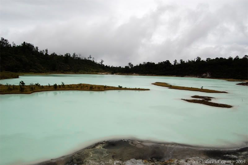
Rancabuaya beach has a height of 000-200 m above sea level, rainfall of 1,200 mm / year with the sun's radiation and small wind power. Coastal waters are blue, the water smells normal, and normal temperature. Average wave height of less than 1 meter, and the seabed material in the form of fine sand, rocks, and coarse sand, including areas along the coastline. The slope of the sloping sea, and overgrown with seaweed and green alley alley as the dominant marine flora. While the dominant marine fauna is tuna and reef fish.
The gently sloping coastal areas have material in the form of pure white fine sand, with a length of 1000-2000 and 100-200 m wide, and a small abrasion level, so that stability eukup good beaches. Dominant flora in the beach is a palm tree and the tree ketapan. Rancabuaya Coast has the quality environment and good hygiene, and almost not there are various forms of pollution. This beach has free visabilitas with low noise levels.
Administratively, in the north bordering Rancabuaya
Caringin village, west of the Indian Ocean, south of the Village Indralayang, and next timu, adjacent to the Village Sinarjaya. Seeara natural, natural environment into this coastal boundary is farmland and perkebuna! L in the north, Ocean Indonesia in the west and east, and farmland in the south.
The beach is located in the village Raneabuaya Purbayani Caringin District has an area of ​​10 ha with a total land area of ​​1524 ha. Oari entire area that has been utilized for the construction of tourist facilities:? 2 ha.
The power source in the district is derived from the PLN with a voltage of 220 volts and a good distribution, while the source of clean water from the River and River Cihrashas Cihideung having a clearer water quality, a sense of fresh water, and odorless. For waste disposal systems in coastal areas use non-permanent trash scattered in the coastal area. Communication systems in the region use the phone with an adequate amount.
There are 2 nature tourism activities that can be done by the tourists who visit this attraction, which is the active nature hiking and tracking as well as the passive is to enjoy the scenery.
Tenure Rancabuaya coastal areas is 70% owned land and the rest is rural land, while managed by Kompepar (tourism movers Group) whose members consist of local communities.

Special Aspects
This beach area has 22 pieces owned villas and lecturer mahasiswali ITS, and 4 pieces lodging in good condition, 40 fruit stalls in good condition, and a parking lot area of ​​3 hectares which can accommodate 100 buses, the condition is still under construction with a layer of soil surface adequate shade and vegetation.
On the beach is provided 2 pieces of public tDilet privately owned, with the level of cleanliness / sanitation and building conditions quite well. rinse place 2 pieces with the conditions and the level of adequate sanitation, shelter (shelter) 2 with the condition and cleanliness of fruit that is quite good. Not far from the beach location terdapatpos health is a public health facilities for the community.
The exit-entry ticket that serves as a post there is a fruit with a sufficient condition. Entrance to the beach designated manager of Rp. 1000,-l people.

Accessibility
Tools that can be used to transport shoreward In. is 3 pieces minibus (bus 3 / 4)-Garut route Rancabuaya the frequency of scheduled and operate between the hours of 4:30 to 8:00. For transportation to the region, may also use non-scheduled public transportation or transportation vehicles to use the village called "paranggong" a pickup.
Distance from the capital of the region Rancabuaya Loaded Java Province 167 km, and distance from the Capital District 105 km, and distance from the center helper District (Caringin) 30 km.
Access to the Beach Rancabuaya of highway districts with width 6 m and a length of 120 km, while access in the region or to the beach area of ​​4 m wide road with fairly good condition.

Kampung Sampireun is a nuanced Village Resort Sunda


Kampung Sampireun is a nuanced Village Resort Sunda, located at an altitude of ± 1,000 meters above sea level, located in the village of Kampung Ciparay Sukakarya Samarang Garut district, West Java with an area of ​​± 5.5 acres including extensive Situ Sampireun (1.5 hectares) with the eyes of seven eyes water. Kampung Sampireun has 22 bungalows consist of 8 units of type Kalapalua Suite (One bedroom & terrace), 4 units of type Kurjati Suite (One bedroom, living room, & patio), 6 units of type Waluran Suite (Two bedrooms, living room, & terrace), 1 unit type Cikuray Suite (Two bedrooms, living room, and terrace), 1 unit type Papandayan Suite (Two bedrooms, living room, & patio), and 1 unit type Manglayang (Three bedrooms, living room , & patio). bungalow is designed with typical House Stage Tatar Sunda Parahyangan. Also Sampireun Village has facilities: "Bamboo Flute Restaurant", "Bale Princess Amantie Multifunction Room", "Waroeng Coffee"-style village as a place of interaction Village Citizens (Customers and Employees), Traditional Meeting Room "Umbrella Kiara Meeting Room" which holds up to 30 people, "Taman Dayu Sanghyang" which can be used as a place of "Dinner Party", Swimming Pool and "Taman Sari Royal Heritage Spa" which stood in 2003, Grand Opening of the Spa are performed by Amelia Vega, Miss Universe 2003.And facilities "Children's Playground"

The village itself is taken from the name Sampireun Situ (Lake) Sampireun (in Indonesian language means Place of Shelter). This lake has a water source large enough that are still used by local communities to irrigate rice fields. In one corner is still maintained garden of bamboo shades add cool and calm with the sound gemerisiknya, a shady pine forest plants and other corners of beautiful arranged with the theme "Tropical Gardenlust". With a very cool temperature between 12 ° C-18. ° C, and the unique concept of "Back To Nature" Kampung Sampireun a favorite place for people to spend their honeymoon and weekends for individuals who need a break from daily routine -day in the big city.

With each bungalow is equipped boat for the guests who stay to enjoy the feel Situ Sampireun Mas accompanied by thousands of fish that will accompany when boating.Guests also can enjoy the show "Calung", ie the traditional arts are staged every afternoon on the raft in the middle Situ. And at night the guests will be in "Nina Bobo out" by the strains of lute flute played by the group of art Kampung Sampireun while peddling "sekoteng", a traditional Sundanese beverage to warm the body.

For newly arrived guests would be served "Welcome Drink" form "Bajigur" traditional drink made from coconut milk, Red Sugar and Pandan leaves served warm, as well as small snacks in the form Rangginang, Ranggining. Afterwards, guests will be escorted from the lobby to the bungalow in a unique way is by using boats or rafts.

One of the facilities of the resort is the Taman Sari Royal Heritage Spa. SPA has 2 Villa, 2 room standard, 5 therapist, a meditation room, 1 room body sauna, herbal bar and also a mini pool. Given a 30% discount for all treatment for those who stay at Kampung Sampireun (Except sauna and special promos.)

The packages are offered is also quite diverse. Starting from the Pack Meeting, Outing Packages, etc.. Parcels are privileged in Kampung Sampireun Honeymoon Package.Special because it is supported by the location of Resort is surrounded by mountains, Garden - garden flowers to give the feel of the village of thick, beautiful and exotic, far away from the bustle of the city. By taking this package, honeymoon guests will be pampered by a variety of services such as:
  • Floating Candle light dinner on the raft
  • Floating on a raft Foot SPA
  • Tretment SPA for both
  • Village Tour
  • Gift
  • Etc.
Kampung Sampireun will try for their honeymoon at this resort will get the most beautiful experience unforgettable.

other foto


Cijayana Beach

Cijayana Beach is one of the beaches in the area Pameungpeuk-Garut potential to be a tourist beach. The beach is precisely located in the Village Cijayana Mekarmukti Garut district has a total area of ​​approximately 9 ha with the general configuration of flat land and gently sloping land with a slope stability and soil is good soil absorption. This beach has the type of soil material in the form of fine sand with brownish white natural color.Cijayana beach is a beach that has a wide beach with a width> 200 m and a length of> 2000 m, and pandanus bidur as the dominant flora at the edge of the beach.

Stability is a good beach for a small abrasion level, and have a fairly good water conditions, such as the blue color of water with normal water smell and temperature normal. Cijayana Beach has an average wave height of 1 m, and wind power and solar radiation is sufficient, so that it can be developed on the beach sunbathing activities.Environmental quality at this beach and not enough there are various forms of pollution, cleanliness and condition of the landscape was still not exploited. This was due Cijayana beaches untouched by the wide range of tourist facilities, especially facilities.To enjoy the scenery on the beach this Cijayana, visabilitasnya very free and has low noise level.

As for the infrastructure as a whole infrastrur are reviewed from the nearest residential locations, namely in the form of electricity resources come from PLN (to the nearest residential areas), the source water comes from wells? wells located in residential areas that have adequate water quality both in terms of clarity, taste, and smell the water is normal. To go there Cijayana coastal highway with a class; road district that has a width of 3 m, there is road access to the location of the beach with a road width of 3 m and length <1 km with sufficient quality. As for public transport vehicles which have a motorcycle taxi and costs around Rp. 2000-5000 / person (from the village closest to the location of the beach). Support facilities in nearby settlements which formed as a stall; located in front of the entrance to the beach location, places of worship in the form of small mosque residents, PHC health facilities in the form of a servant, and security facilities that support the safety of local villagers to the location.

This beach has a small lake on the edge of the beach location. And activities that can be done on the beach that still has not managed it is, enjoy the scenery, photography, fishing, picnicking, sunbathing, sightseeing, and playing on the beach. The pattern of land ownership from the coastal village land Cijayana is dedicated to agriculture, the allocation of places for tourism, and most are still in the form of vacant land that has not been managed.

Read Source >>